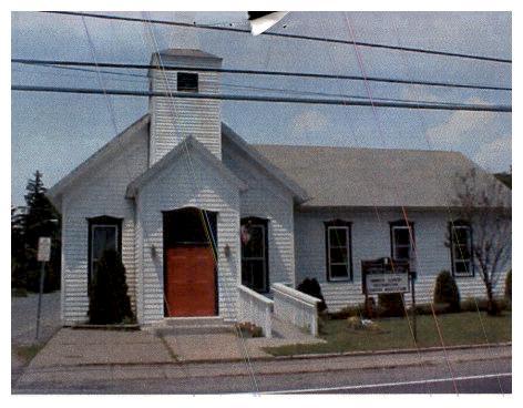
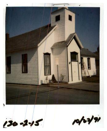
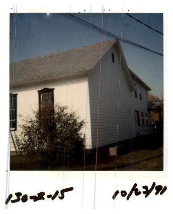
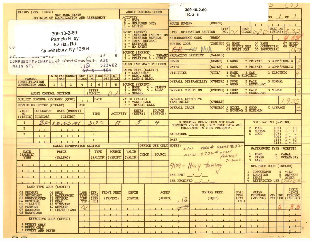
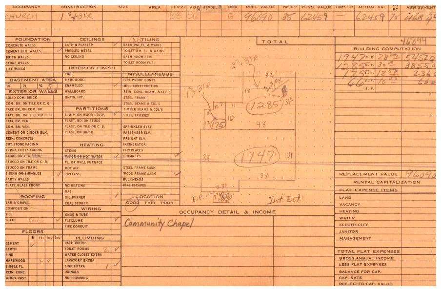
309.10-2-69 * 55 Main St
Please Notice:
- To see the content pertaining to this parcel click the + image to hide click the - image in the main section header you are looking to view.
- When printing, if you click the + (show) or - (hide) you can print only the information you wish to see
- If you would like to Hide / Show all, click the appropriate link below
Hide All | Show All


Parcel Information:
| Parcel | Location | Acres | Property Class | School District | Ward |
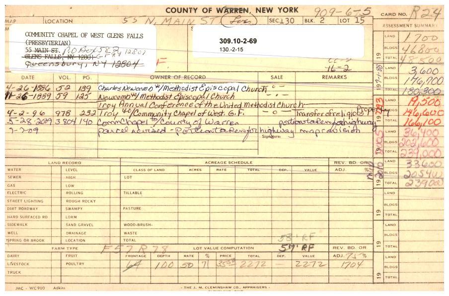
| 309.10-2-69 | 55 Main St | 0.12 | 620 - Religious | Queensbury Un.fr.sd | Ward 4 |

Owner Information:
| Owner | Owner Address | P.O. Box | Owner Address Line 3 |
| Pamela Riley | 52 Hall Rd | | Queensbury Ny 12804 |
| Parcel | Assessed Land Value | Assessed Total Value | Uniform % | Full Market Value |
| 309.10-2-69 | 28,800.00 | 265,900.00 | 90.00% | 295,400.00 |

Images:

Sales Information:
| Sale Date | Sale Price | Net Sale Price | Book | Page | Sale Type | Cond. Code | Arms Len. | Land Value TOS | Tot. Value TOS | Prior Owner |
| 11-06-24 | 50,000.00 | 50,000.00 | 7006 | 19 | Land & Building | Other | No | 28,800.00 | 265,900.00 | Community Chapel WGF, |
| 04-02-96 | 1.00 | 1.00 | 978 | 232 | Land & Building | Not Warranty | No | 19,500.00 | 166,100.00 | Troy Annual Conference, |

Site Information:
| Site # | Nbhd Code | Sewer | Water | Utilities | Site Desire | Nbhd Type | Nbhd Rating | Road Type | Entry Type | Zoning Code |
| 1 | 408-Exit 18 - Main | None | Comm/ public | Gas& Elec | | | | | No entry | MS |

Land Information:
| Site # | Land # | Type | Front | Depth | Acres | Sq Ft |
| 1 | 1 | 01-Primary | 0 | 0 | 0.12 | 0 |

Residential Building Information:

Commercial Building Information:
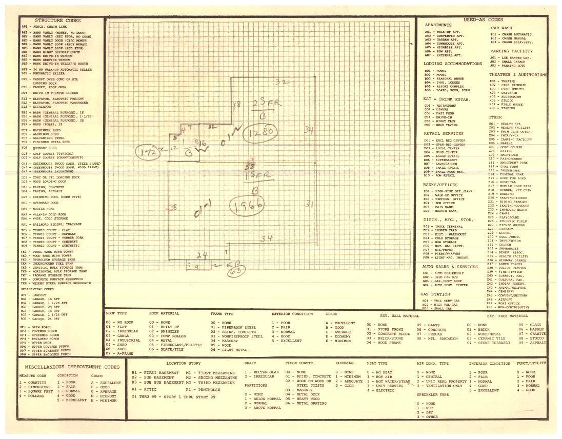
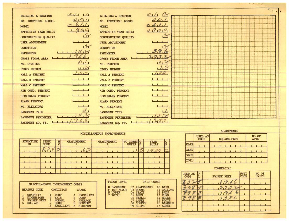
| Site # | Bldg # | Section # | Boeck Model | Yr Built | Gross Floor | Bldg Perim | Stories | Wall A % | Wall B% | Wall C % |
| 1 | 1 | 1 | Church, 1sty Basic Design | 1900 | 1966 | 192 | 1 | 100 | 0 | 0 |
| 1 | 1 | 2 | Church, 1sty Basic Design | 1900 | 2732 | 396 | 2 | 100 | 0 | 0 |

Improvements Information:
| Site # | Struct Code | Dim 1 | Dim 2 | SQ FT | # | Constr Grade | Overall Cond | Yr Built |
| 1 | RP4-Porch-enclsd | 0 | 0 | 63 | 1 | Average | Normal | 1990 |

Special District Information:
| Special District | Units | Taxable |
| EM001-Emergency medical | 0 | 265900 |
| FP007-Fire protection | 0 | 265900 |
| LB001-Crandall library dst | 0 | 265900 |
| LT007-W.queensbury light | 0 | 265900 |
| SE025-Gr Qsby Consolidated | 2.22 | 0 |
| WT021-Qsby water exmpt. | 0 | 265900 |

Exemption Information:

Permit Information:
The information in the  RPS database is maintained by the Town of Queensbury Assessors Office
 2025 Assessment Values: